Image Courtesy Paul Toth
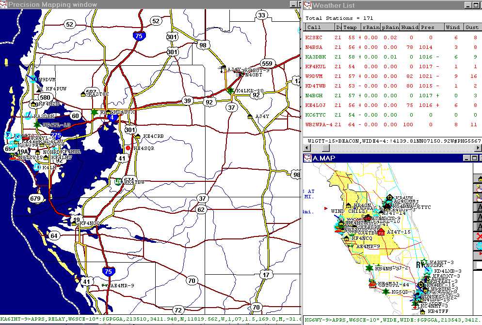
To the left of the screen is an expanded map covering most of the Ruskin NWS service area. To the top right of the screen is a seperate window showing the actual data in text format and on the lower right you will find yet another window with an overview of activity at the state level.
The small blue dots that you can see in the bay area map and the anonomiter icon on Rt 98 north of the Rt 92 intersection are all remote weather stations. The dark blue lines emerging from the light blue dots are showing viewers the bearing and speed of measured winds at that location. The higher the speed the longer the line, for instances where exact speeds are needed users can look at the data window. NWS office in Ruskin has been a very strong supporter of both the Skywarn and the APRS program in West Central Florida for the past several years.
![]()