javAPRS and TIGER Maps
Additional info is available at
http://ohioaprs.net/files/greg/tigermaps.html
Many people are aware of the
TIGER map generator
available on the internet courtesy of the
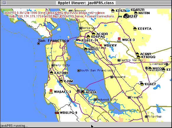
Census Department. javAPRS now has the ability to access this server, and put APRS
data on the maps. Here is an example:

There is a problem with using these maps. javAPRS
assumes a linear projection, where each pixel covers the same latitude and longitude
regardless of where on the map it is. This makes it much faster to plot points, at the
expense of some distortion, especially on wide area maps. TIGER uses a different
projection, which results in some errors in icon placements. These errors are minimal
on small area (city-wide) maps, but become huge in wider (state and country) maps.
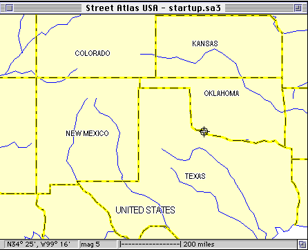
Here are two sample maps of the same area. Everyone proabably is able to visualize the
"Four Corners" area of the southwest, Arizona, New Mexico, Colorado, and Utah. These borders
run true north/south and east/west. The first map here is made from
the DeLorme CD ROM. Notice the 4 corners area, the lines are vertical and horizontal.
This is a linear projection.

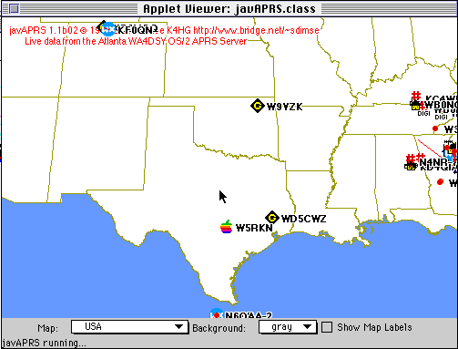
Here is the same area as depicted by the TIGER system. Notice the north/south line is now
a curve. This is a result of the sinusoidal projection. It looks like it would to someone
in the space shuttle; realistic, but it complicates converting between x,y coords and lat/lon.
The code supplied by TIGER to accomplish this is 10 pages long. My code for linear projection
is one line!

Mac/Win/javAPRS all use this linear projection. People have sworn to me that APRSdos uses
sinusoidal projection. Could someone display the same approximate area on APRSdos, and tell me
if the line is vertical?
Why isn't there a live javAPRS applet here?
Java is a language designed for networking applications. One of the principle
concerns is security. Java's built in security manager prevents someone from putting
an applet on a page that erases your hard disk, sends files from your hard disk to
another computer, or other such anti-social acts. Unfortunately, it also gets in the
way of some cool programming. It prevents an applet from accessing any computer
other than the one it was loaded from. So if I could put javAPRS up on the TIGER
computer, the map display would work fine.
I can't do that. There are two options...the first is to disable the security manager.
Netscape does not have this option, but (I'm told) Internet Explorer does. Also, the
Sun Java Development Kit (JDK) includes an applet runner that can have the security
manager disabled, and also allows you to run applets from your disk, greatly speeding
up access. The JDK is free, and
available from SUN
for most platforms.
The other option is to have the same server that you download the applet from relay the
request to the TIGER computer, and return the GIF file to you. The security manager
has no way of knowing where the map originally came from, so it is happy. Steve Boyle,
KD6WXD, has added this capability to his
TNC data server.
It is in alpha test now, and
as soon as it is open for general use we'll let you know.
In the mean time, if you want to use it with the JDK, here is a link to get the
javAPRS zip file. Unzip the file, and run the tigerTest.html file with the Applet Runner.
You can modify this file to display any data you like, and to set up a different
initial map. The parameters in the applet call sould be pretty self-explanatory.
Mail to mailto:k4hg@tapr.org
Back to javAPRS page
Steve's home page


